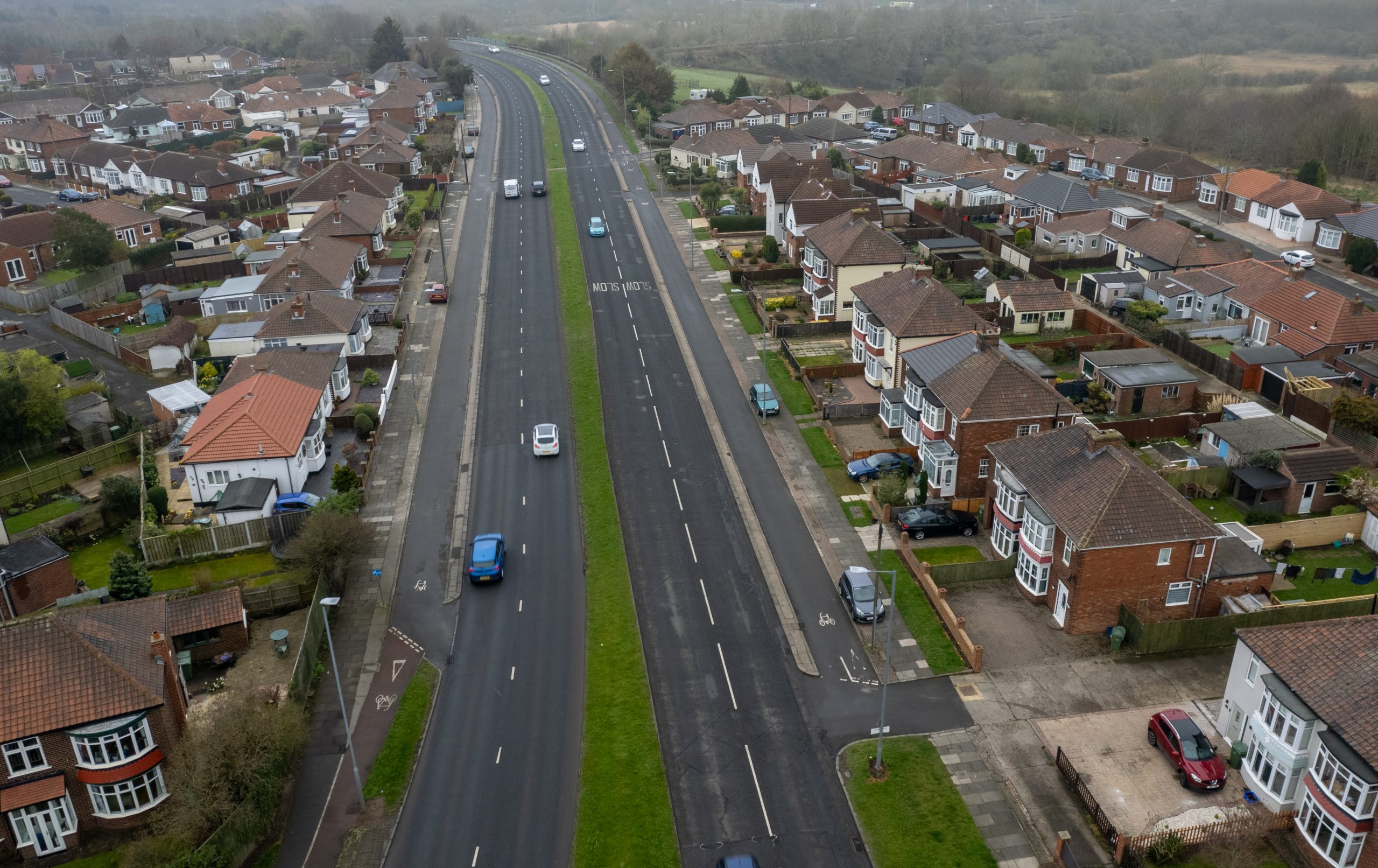
Wolviston Road’s cycle tracks — opened in 1944 — look like service roads and are often treated as such by motorists.
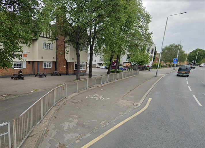
Motorists who park their cars near Sandy Lane on Wolviston Road might be excused for thinking the strip of wide asphalt in front of the 1930s houses, separate from the footway, is a service road. But should they drive south on this strip of asphalt (some do, to the houses), they would soon find themselves behind Armco motorway-style barriers because the “service road” is, in fact, a cycleway granted MoT cash in 1939 and finally opened in 1944.
Lieut.-Colonel S. E. Davies, a Stockton Councillor, had pushed for the widening of the road beside the then Billingham railway station since 1934. (Billingham station was later moved to a more central location to the east.) The wider road would also link up with an earlier bypass. In the 1930s this Billingham Station bypass road and Wolviston Road were parts of the A19.
“I have pressed for ten years for this scheme,” Colonel Davies said in 1944, “and it will be a proud moment for me when the first vehicle passes over this bridge and I know that the scandalous and costly traffic delay will be thing of the past,” he said.
(The bridge — at https://goo.gl/maps/hUWp21Pafsc5kNPF8 — was named for him and it’s still the Davies Bridge on OS maps. The cycle tracks on the bridge are surfaced with red asphalt, and cyclists and pedestrians are protected with Armco barriers. )

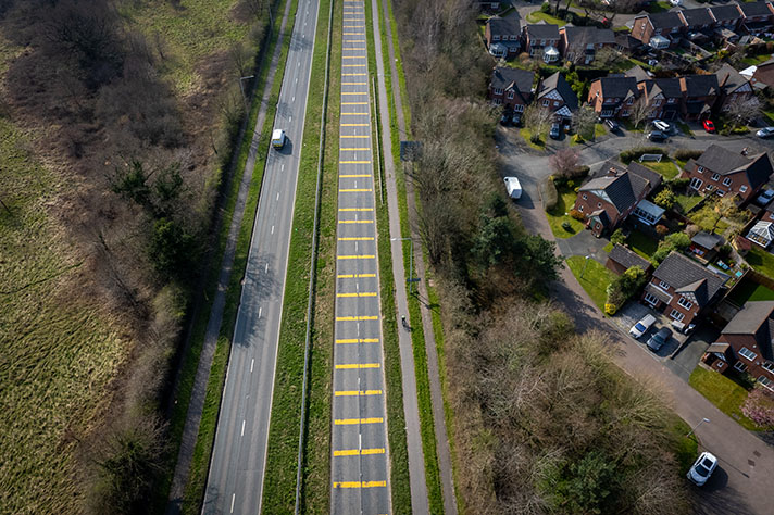
Wolviston Road’s cycle tracks are, unusually, 10 ft wide.
The stretch of A19 between Haverton Hill Road and the slip road before the A139 is partially on the 1930s route of the A19 (“Fleet Bridge Road”) — the slip road is on a new alignment with the old A19 now a footpath and cycleway to the west of the ponds of Billingham Beck. This now marooned stretch of the old A19 links to a roundabout that leads on to Bypass Road (the new and much shorter name for “Billingham Station Bypass Road”) which becomes Wolviston Road as it nears the suburb of Wolviston.
“The new by-pass road and bridge at Billingham-on-Tees, built to affect a speedier traffic link between Durham county and Tees-side, was formally opened to-day,” reported Hartlepool Northern Daily Mail on 15 August 1944. “The road is 100 ft. wide and has dual carriage ways, cycle tracks, and footpaths for pedestrians,” added the newspaper.
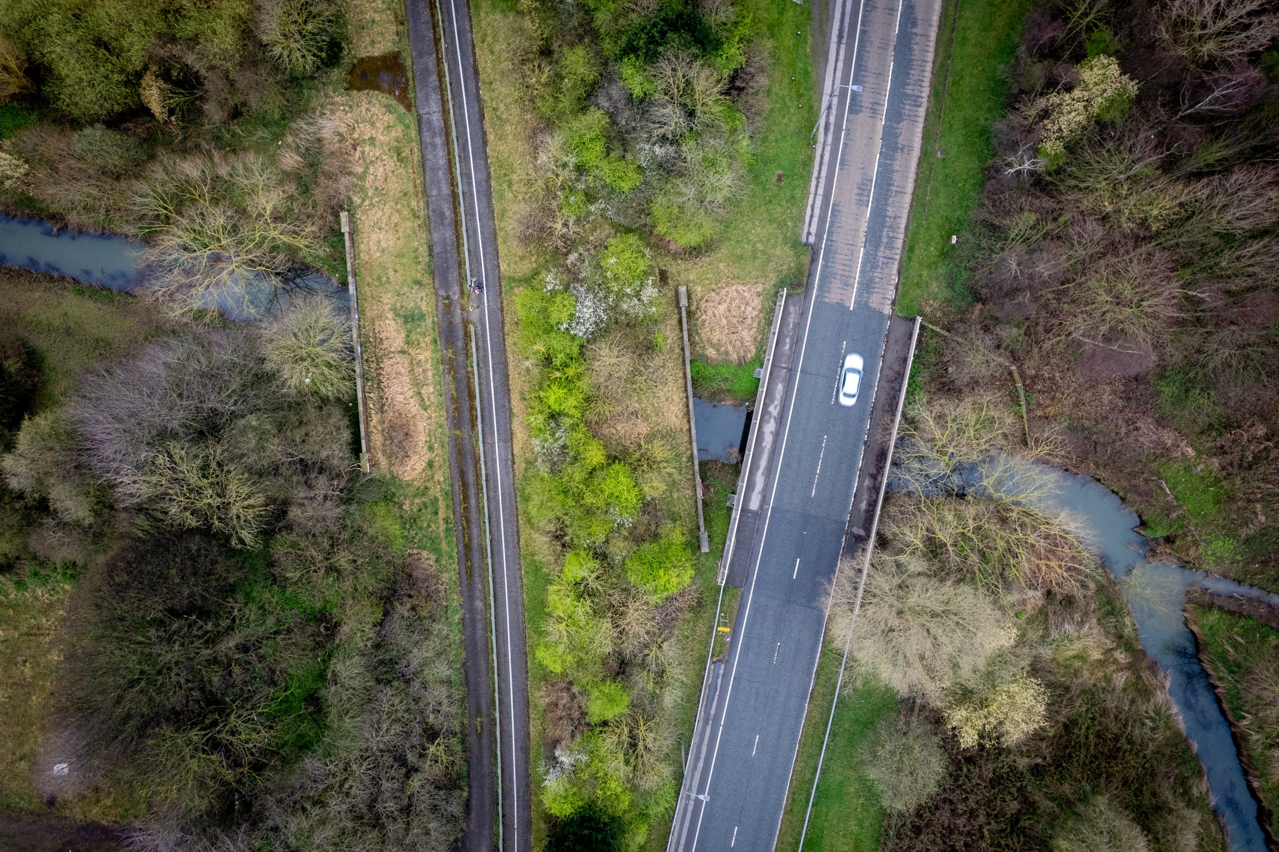
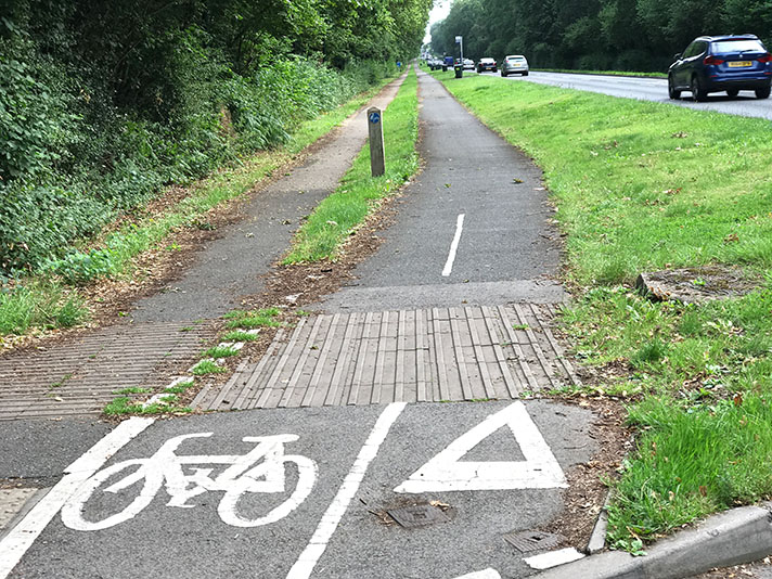
The former route of the A19, on the left, is now a shared-use path for pedestrians and cyclists. The road would have been nearly as wide as the bridge on the flanks.
Other parts of the linked bypasses were also supposed to be fitted with cycle tracks, said a newspaper in 1939 but it doesn’t look as though these were installed on the A1027.
“Existing sections of the road known as Hartburn Lane, Hartburn Avenue, Oxbridge Avenue and Bishopton Avenue, extend for a mile and a half, and now proposed to put in hand the remaining sections from Durham Road to the Billingham by-pass,” reported the Yorkshire Post and Leeds Intelligencer.

Motorists often treat the Wolviston Road cycle tracks as service roads.
“Dual carriageways, cycle tracks and footpaths will provided on the new sections,” continued the paper.
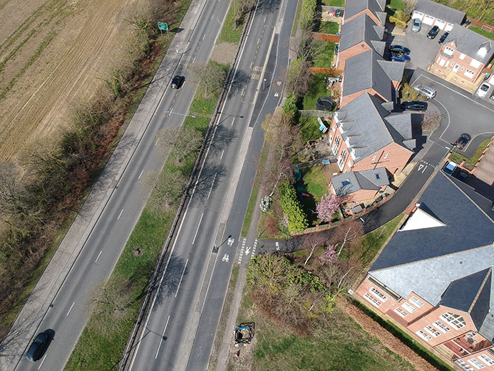
This stretch of the A1027— https://goo.gl/maps/5n7LLmXBgEHwNGmQ7 — has flagstone-surfaced footways, but no cycleways.
“And,” added the paper, “it is contemplated that similar accommodation will be provided ultimately on the existing lengths of road which at present have only one carriageway.”
The A1207 here — https://goo.gl/maps/g52qW7967Hq4wu6n8 — still has one carriageway but clearly much of the land was sterilised for a later road widening that didn’t happen.
“Two new bridges will be necessary, one under the L.N.E.R. line and the other over Billingham Beck,” stated the newspaper. This is the one at Billingham Beck: https://goo.gl/maps/uNp2cKyioNj7iAwL8 — it is now a shared use path but was once the A19.
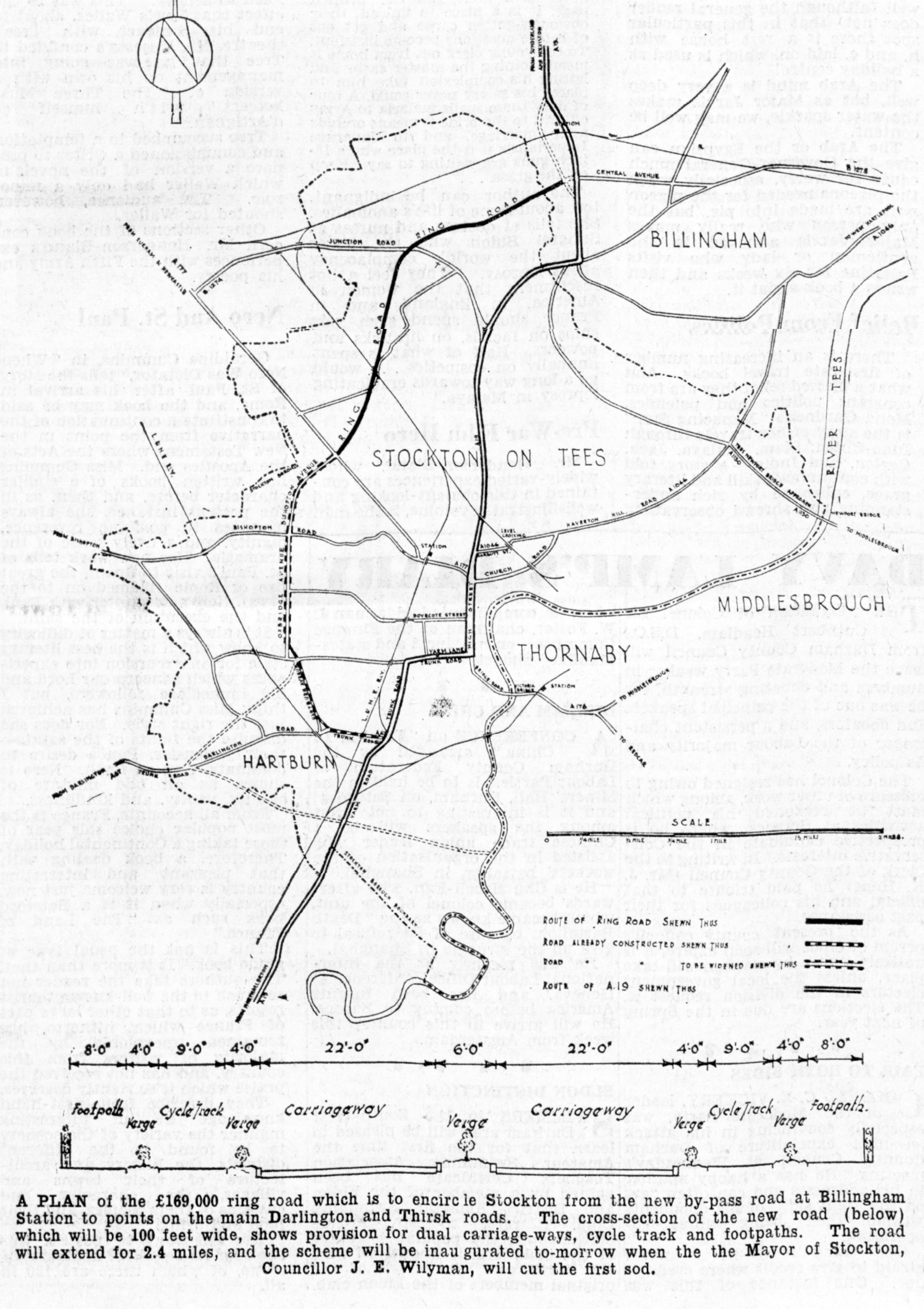
Billingham bypass map, from Daily Gazette for Middlesbrough, 28 July 1939.
The roads featured here attracted a 75 percent MoT grant, which was the level of funding that the Ministry provided to local authorities willing to add cycle tracks to their planned dual carriageways.
“An intimation was received by the Town Clerk of Middlesbrough (Mr Preston Kitchen) to-day that the Minister of Transport has approved the scheme for the Billingham Station by-pass road and the new approach road between the Tees (Newport) Bridge and Billingham on the north side of the river for a 75 per cent grant,” reported a newspaper in 1937.
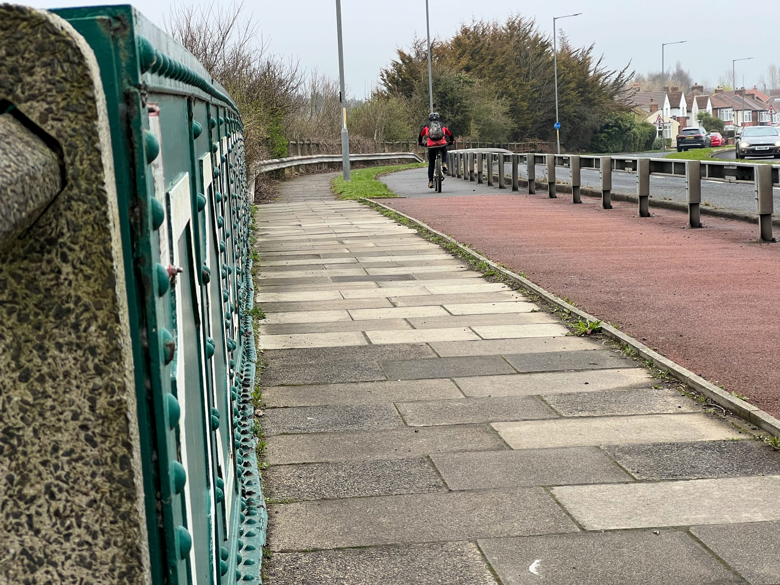
Concrete fencing — and red asphalt — on Davies Bridge. Cyclists are also protected by Armco-style barriers.
“The construction of the approach road, nearly two miles long, will enable the full advantage derived by the building of the Tees Bridge to be derived by traffic passing through Middlesbrough to West Hartlepool or Sunderland,” added the newspaper.
“The approach road to the bridge will 100 ft. wide, allowing for the most modern form of lay-out. including dual 22ft carriageways, cycle tracks, and footpaths.”


