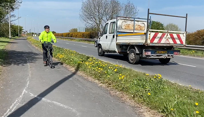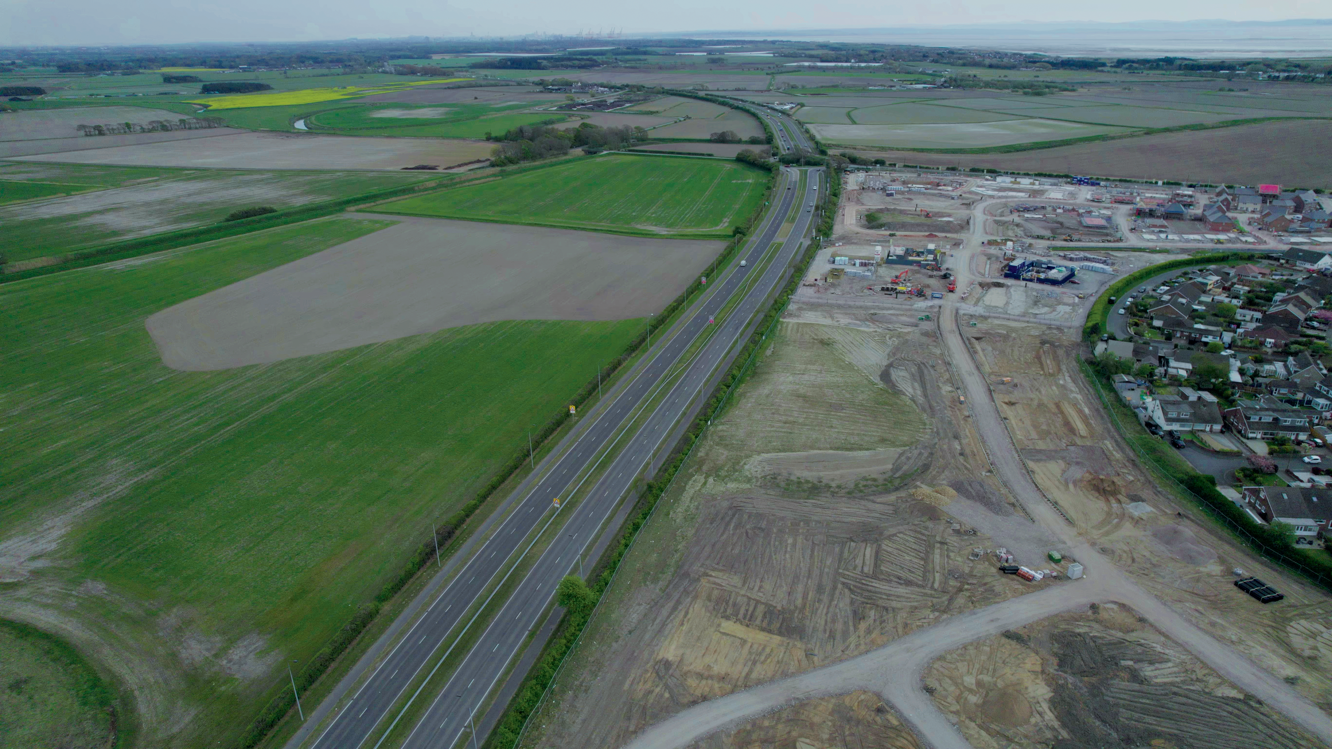
Use of the cycle tracks on the Formby bypass could grow thanks to new housing estates — the tracks will link the residents with a nearby supermarket.
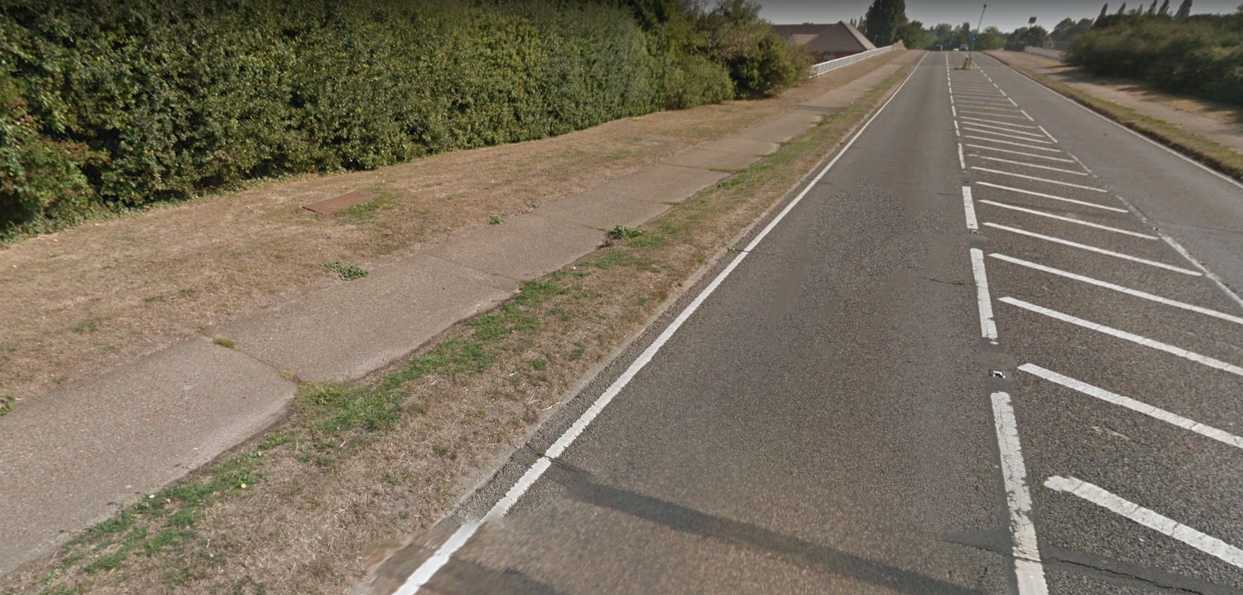
The four-mile dual carriageway bypassing Formby opened in 1938 with 6-ft-wide footways adjacent to 9-ft-wide cycle tracks. A period document reveals that the footway had a pink asphalt surface, and the cycle tracks had a non-skid green asphalt surface (none of which has survived).
The Formby bypass was considered such a technological innovation that Lancashire County Council produced a 16-page commemorative brochure for the opening of the road. The bypass was opened with great civic pride at midday on Saturday, 10 December 1938, and a map included in the brochure even pin-pointed the exact location of the dais from which the Earl of Derby, Lord Lieutenant of Lancashire, gave a ribbon-cutting speech to a “large assembly.”
“On the covered stand erected for the occasion,” stated a report in the Formby Times, “was grouped a representative company of county and local notabilities.”
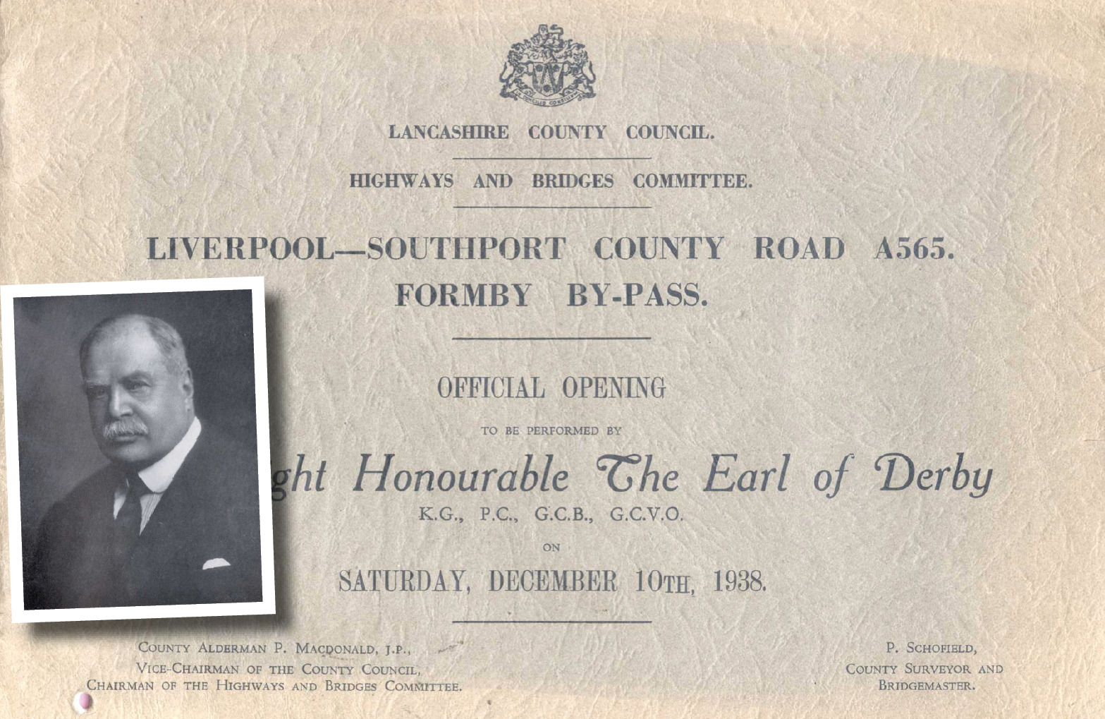
Alderman P. Macdonald, the vice-chairman of the county council’s highways committee, said the bypass was “laid out on the most modern lines and constructed according to the requirements of the Ministry of Transport.”
(It was the Ministry of Transport that stipulated that the road should have cycle tracks. It had been initially planned in 1928 as a narrower road without cycle tracks.)
“Whilst it cannot be claimed that this road is an industrial road, it does carry a very considerable weight of through commercial traffic between the great city of Liverpool and the beautiful town of Southport,” continued Macdonald.
That commercial traffic included cyclists, of course, of which there was an increasing number in the ten years before the building of the bypass. A traffic census conducted on the old road — the findings of which were included in the brochure — counted 530 cyclists in 1928, and 2,291 in 1938, a four-fold increase. In the same period, motor-car use only doubled.
The bypass, said Macdonald, reported in the Formby Times, was “divided … by two carriageways with a central reservation and a cycle track on either side, along with a good footpath.”
The newspaper said he hoped that “by this segregation of traffic that accidents will be reduced, that the flow of traffic will be facilitated, and the comfort of users will be added to.”
The highways committee vice-chairman thanked those “who had contributed to the making of that very fine road,” stated the Formby Times. He praised the county surveyor Mr. Schofield, his chief assistant, Mr. Wordsworth, Mr. Haywood, resident engineer, and building supervisor Mr. Gore working for W. Turner (Ardwick), Ltd., of Manchester.
“He then asked Lord Derby,” reported the paper, “to step down into the road-way and formally declare the road open as the King’s Highway for all time.”

According to the commemorative brochure, the four-mile-long road was 120 feet wide “between fences” with dual carriageways 22 feet wide. There was also a central reservation of 22 feet and “cycle tracks nine feet wide and footpaths six feet wide, with grass margins.”
The bypass cost £195,483, “towards which the Ministry of Transport indicated a grant of 60% on 17th April, 1936,” stated the brochure.
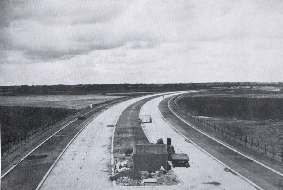
Commemorative brochure’s photograph of the construction of Formby bypass from North End Lane looking north. Space has been set aside for footways and cycle tracks on each side of the road.
“Work was commenced on April 9th, 1937 [and] the bulk of the general contract work was completed by September 1938,” said the brochure, adding that 75 men had been employed on the scheme.
“The carriageways have been constructed of concrete, 12 inches thick (which forms the running surface), laid on a consolidated bed of clinker ballast 9 inches thick,” stated the brochure.
The brochure continued: “Splayed kerbs are provided on each side of the central reserve as a safety measure. The near side kerbs joining the cycle tracks are 10 inches by four inches and are laid directly on the extremity of the concrete carriageway slabs.”
The cycle tracks were constructed with “6 inches consolidated foundation of clinker ballast covered with a binder course of tarmacadam [one and a half] inches thick over which is laid a [three-eighths-inch] layer of sand carpeting, squeegeed with bituminous compound and covered with [three-sixteenths of an inch] gauge green chippings evenly distributed and lightly rolled to produce a matt, non-skid surface finish.”
Furthermore, the “near-side concrete kerb of the cycle tracks is set sufficiently low to prevent cycle pedals from coming into contact with it. And the offside timber kerb is fixed flush with the surfaces of the cycle track and adjacent grass margin so that it can be overrun in the case of an emergency.”
“The footpaths are constructed in a similar manner to the cycle tracks,” continued the brochure, “except that the foundation of clinker ballast is three inches thick and the squeegeed surface of the sand carpeting is covered with half inch gauge pink chippings.”
The surfacing of the carriageways, cycle tracks, and footways was done by Cawood, Wharton & Co., Ltd., of Leeds, stated the brochure. The surfacing materials for the cycle tracks and footways were supplied by the Penmaenmawr and Trinidad Lake Asphalt Co. Ltd. of Caernarfon, Wales.
The Formby bypass is one of several such roads with adjacent cycle tracks constructed in Lancashire in the 1930s. To the north, there was the Coastal Road to Southport, and to the southeast, there were cycle tracks on Dunnings Bridge Road in Litherland, and on the A59 at Aintree, Maghull and Aughton.
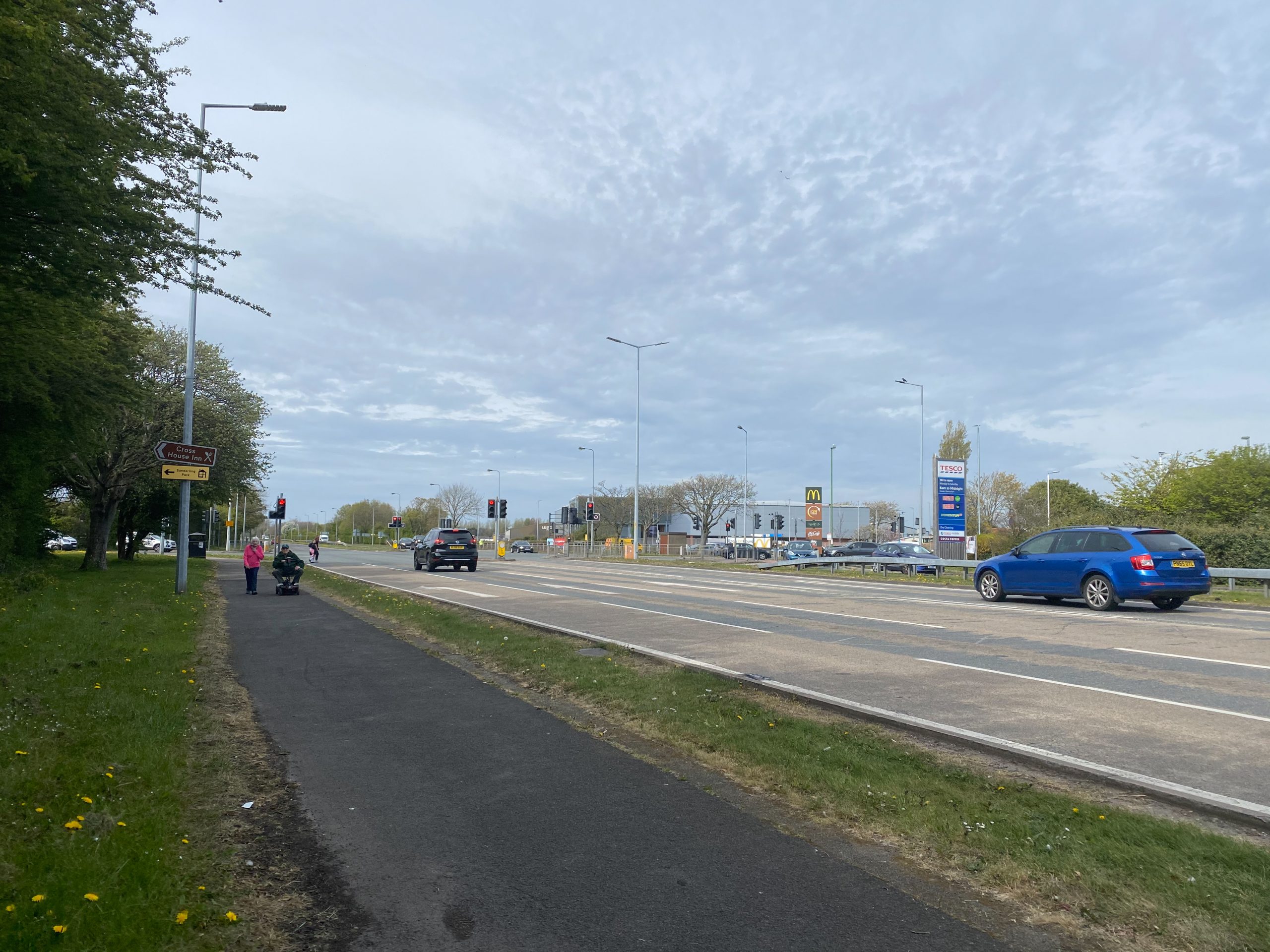
Cycle track isn’t just used by cyclists.
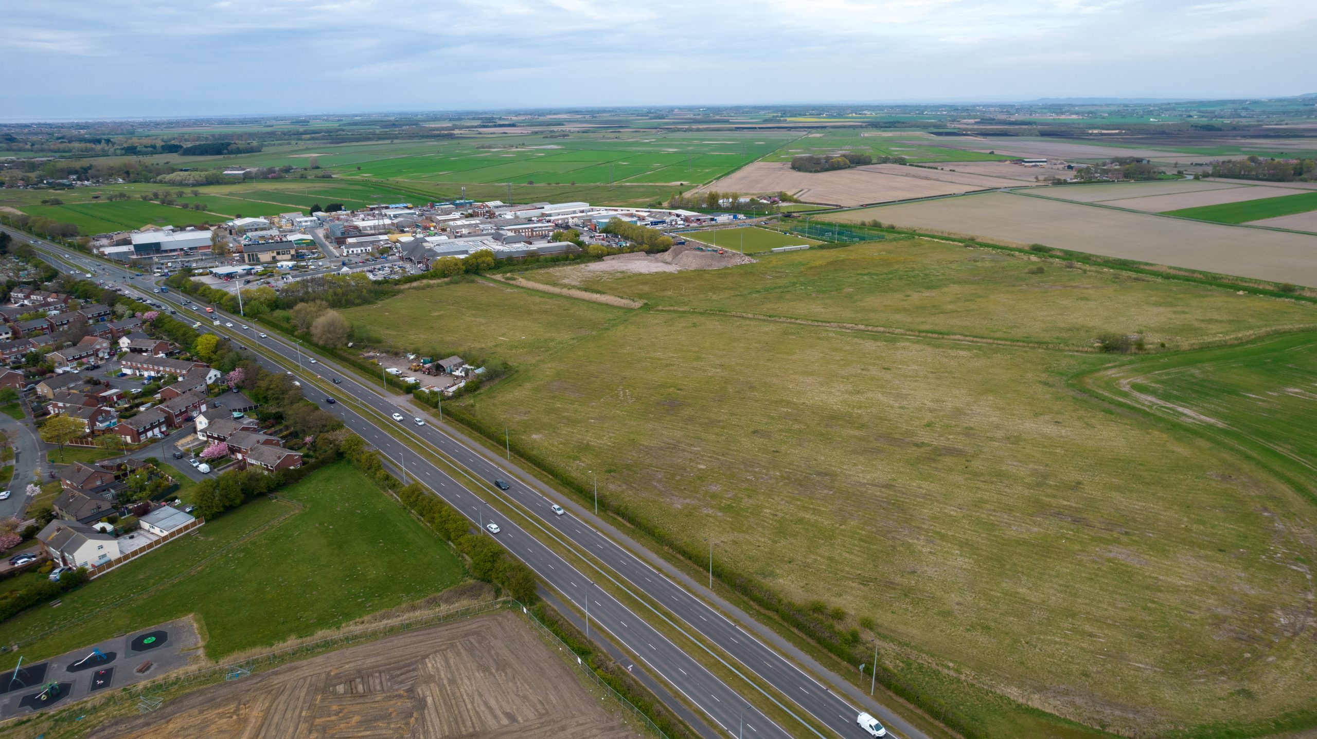
Supermarket and other shops, as well as housing, next to the Formby bypass.
In 2023, part of the bypass cycle track was resurfaced with asphalt and made bidirectional, shows this video:
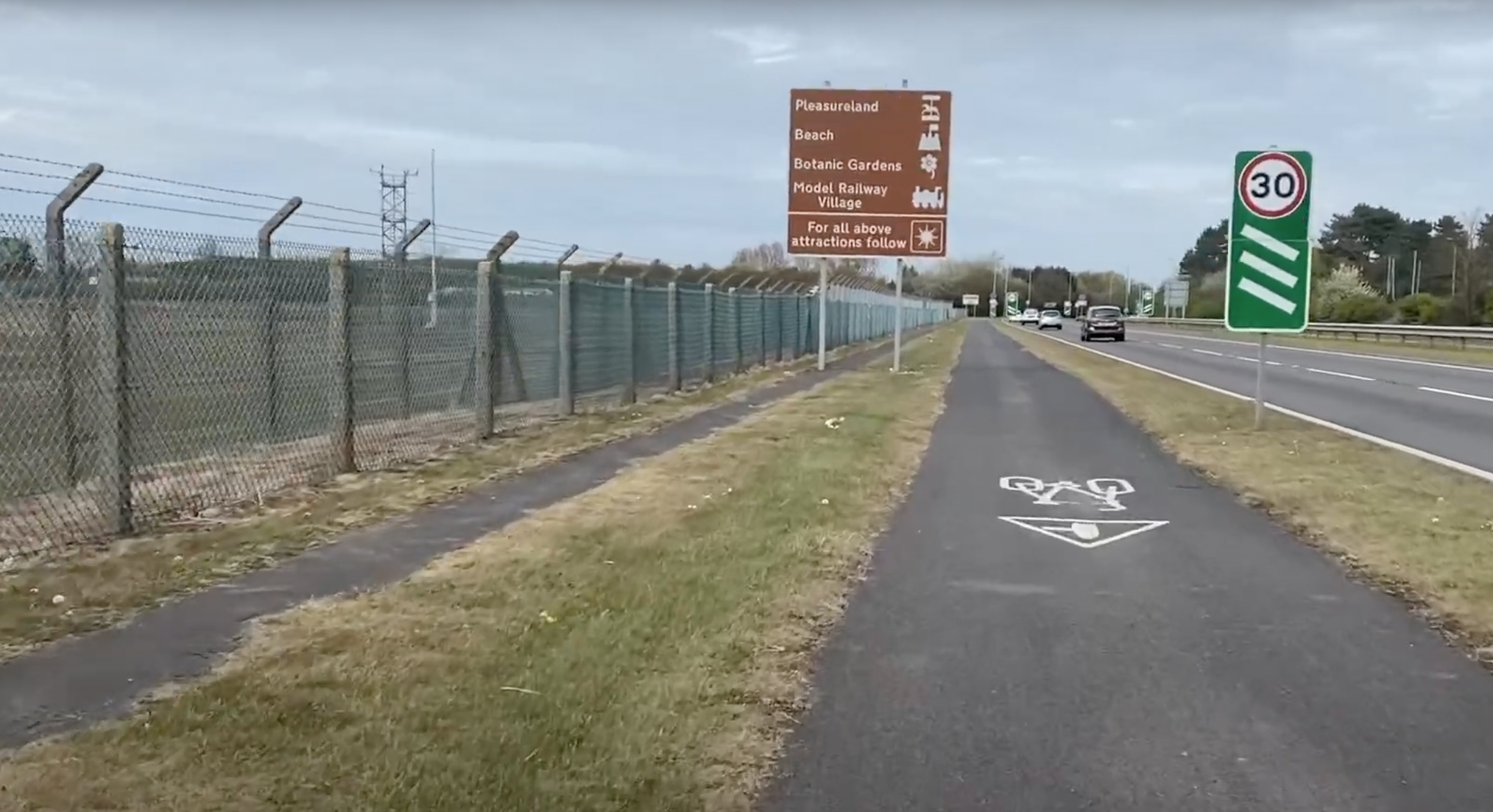
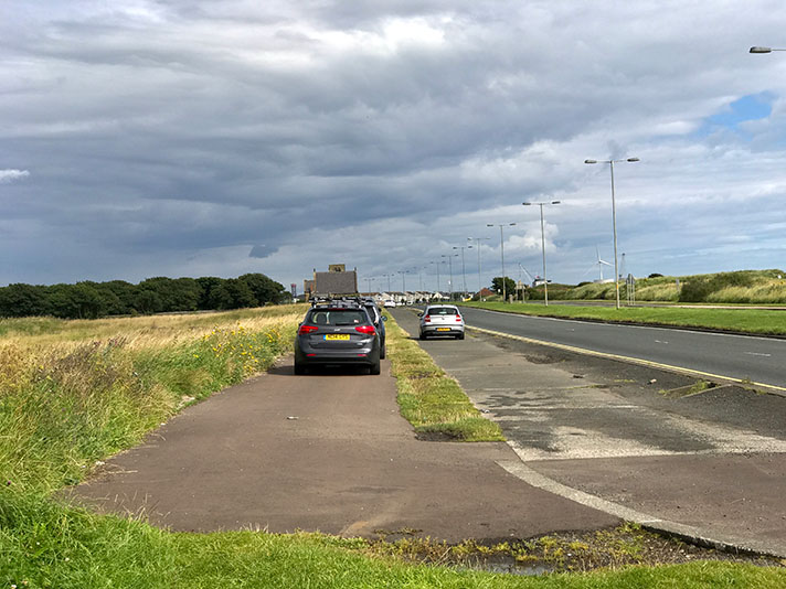
Adjacent footway beside period cycle track at RAF Woodvale near end of Formby bypass.


