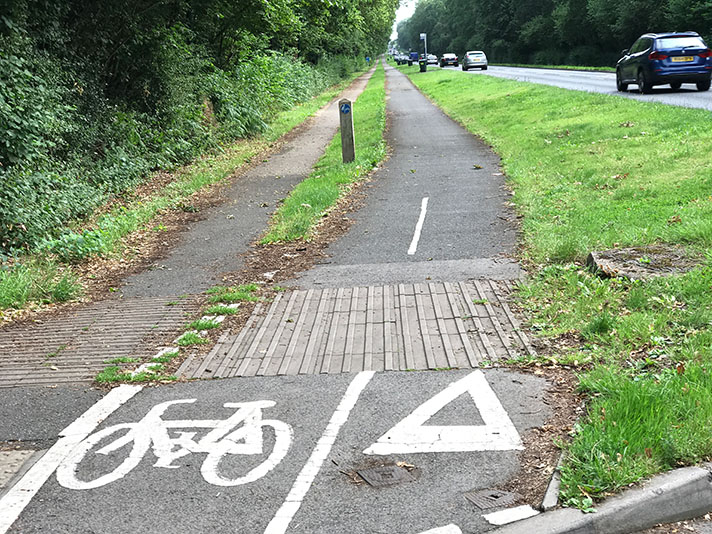
Eastern Avenue, A12, Ilford

OS 1937-61
Modern Map
Date opened/built:

1936.

Length:

3.4 miles (5.48kms).

Width:

6-ft (1.83m).

Adjoining footway:

Yes.

Road type:

Urban dual carriageway.

Surface:

Modern asphalt; some period concrete.

Both sides of road:

Yes, but short section on north side of road, between Whalebone Road and Hainault Road, now gone: https://goo.gl/maps/GeMTdnjZzHEgwP958

Adjacent to social housing:

No.

Period mapping:

OS Six inch, revised 1938, published 1946 https://maps.nls.uk/view/104194281 Cycle track and footway not noted. OS Six inch, revised 1939, published, 1946 https://maps.nls.uk/view/104194332 Cycle track and footway not noted. OS 1:2,500, surveyed 1962, published, 1963 https://maps.nls.uk/view/103197691 Track marked but not noted as cycle track or footway. OS 1:1.250 surveyed 1962, published 1963 https://maps.nls.uk/view/102911743 Cycle track and footway not noted.

OpenCycleMap status:
Sources:

Period maps, newspaper reports, period photographs, Google Earth 1945 aerial layer.

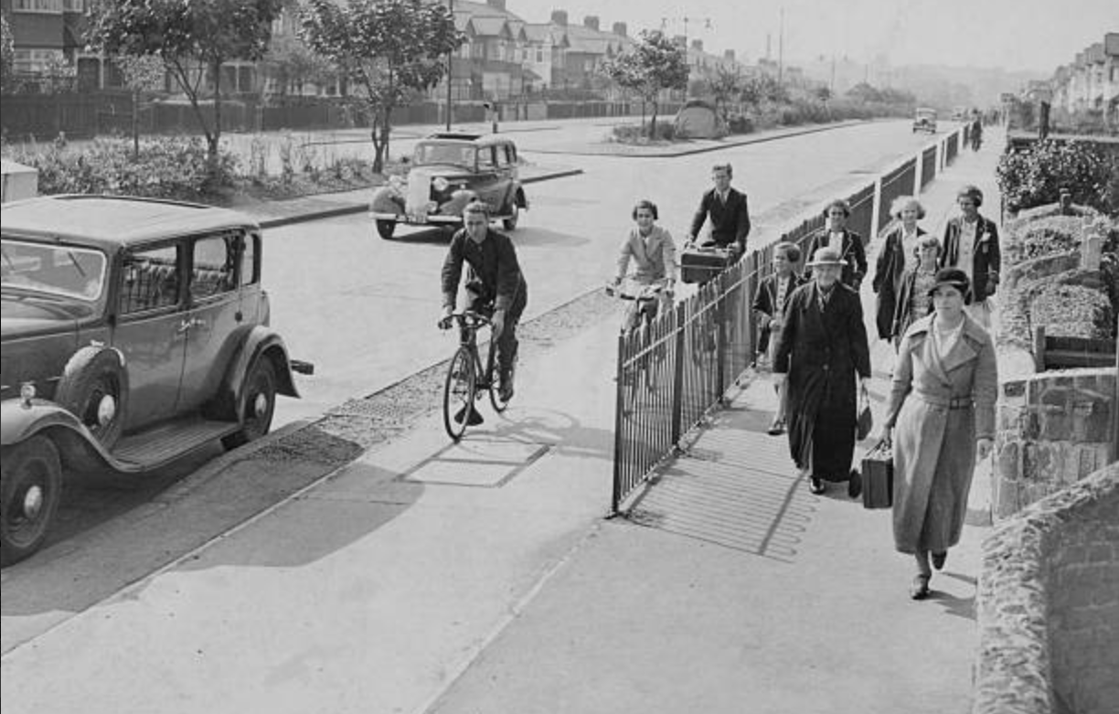
Agency photo of Eastern Avenue, 1937.

In a press agency photograph dated 26 September 1937, two men and a woman — all smartly dressed — are seen riding bicycles on a cycle track on Eastern Avenue, Ilford. On the adjoining footway there are two women, also smartly dressed, and five school girls, four of them in school blazers. The pedestrians are kept apart from the cyclists with steel railings. A car is parked on the road. The central reservation, lined with low kerbs, is planted with shrubs and small trees.

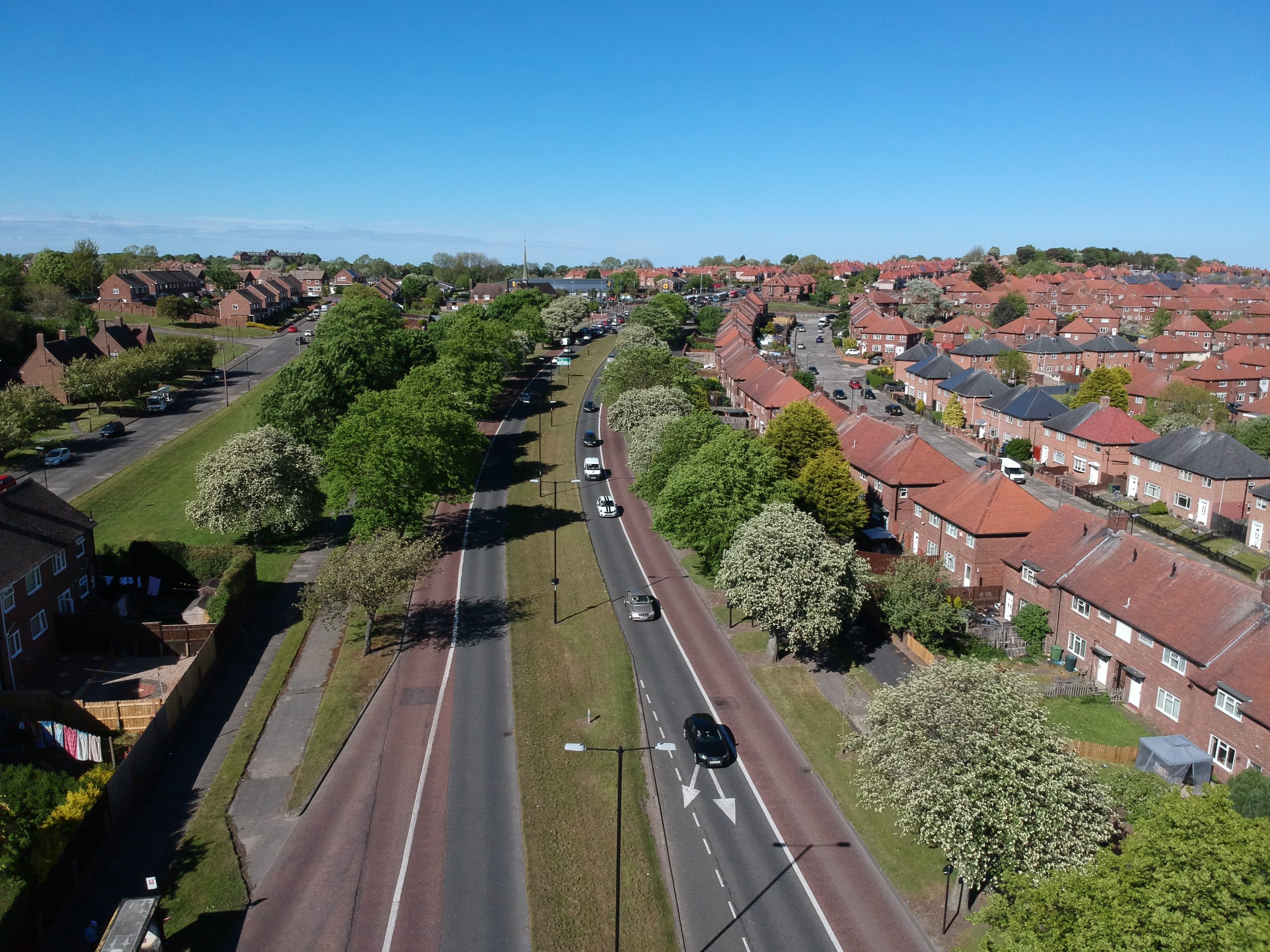
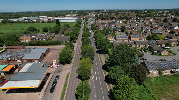
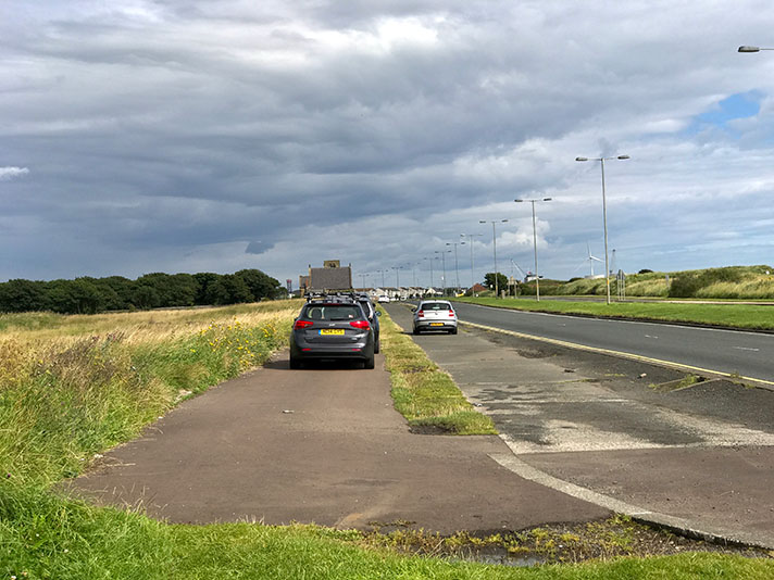
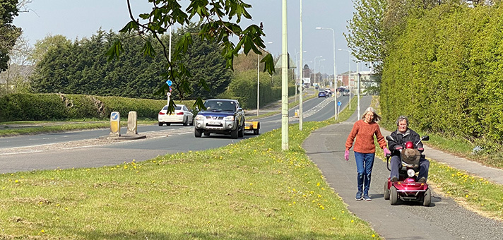
Today, that cycle track and footway are crowded not with people but with parked cars. There are still shrubs and (newly-planted) trees in the central reservation but it has been blocked with steel fencing and motorway style Armco barriers not to defend the greenery but to deflect speeding motorists. Cyclists — of which there are very few visible on Google Street View — are directed to ride on the road, protected with paint rather than separation.

In parts, the former cycle track is now marked out as somewhere official to store cars. The painted cycle-way often leaves the road and returns to what was the original cycle track.

The thirty-mile Eastern Avenue and the Southend Arterial Road to which it joins were built as a single project, starting in 1921. Both roads were officially opened by Prince Henry (later the Duke of Gloucester) on 25 March 1925.

Originally numbered as the A106 the road became the A12 after WWII.

Like many arterial roads of the 1920s, Eastern Avenue was provided with dual-sided wide footways along its full length. Some time after November 1935 — probably in Spring 1936 — these footways were halved on both sides by the introduction of “experimental” cycle tracks.

In 1937 a disgruntled C.T.C. member complained that the cycle track was only 3-ft wide; officialdom said it was 6-ft-wide.

“On the north side only of Eastern-avenue a 3ft strip has been taken from the existing footpath and converted into a concrete cycle track,” griped “F.J.T.” in the Nottingham Journal.

“The footpath is now only 4ft wide being only sufficient for two persons to walk abreast in comfort. Cyclists must, of course, go in single file,” F.J.T. continued.
Some sections of Eastern Avenue’s cycle track is now used for storing parked cars.

Eastern Avenue’s cycle track started close to the Gants Hill junction and extended for 3.4 miles to Whalebone Road, Chadwell Heath.

Meeting on 19 November 1935, the highway committee of Essex County Council “considered a suggestion made by the Divisional Road Engineer, London Division, Ministry of Transport, that cycle tracks should be constructed on the Eastern Avenue, the London-Southend road, and the Barking by-pass. The Committee were in favour of cycle tracks being laid, as an experiment, on a length of Eastern Avenue, and they recommended that, subject to a grant of 60 per cent, from the Ministry, a cycle track, 6ft. in width, be constructed along each side the section of Eastern Avenue between its junction with County Road A1112 and Wanstead Lane at an estimated cost of £6,290.”

The cycle track took space away from pedestrians, with no separation of modes, unlike other schemes of this period.

“The lay-out of a cycle track in Eastern Avenue had been much criticised,” admitted a council highways committee on 18 May 1937.

“The track was laid in the only possible position, owing to the restricted width between the kerb and the fence line, and was adjacent to the footpath,” continued the report.

“There was, however, no defined division between the footpath and the cycle track, and difficulties arose, because the pedestrian and cycle traffic were not properly separated.”

A sub-committee “having made an inspection, were definitely of the opinion that it was necessary that the cycle traffic should be segregated from the faster and the heavier traffic, and that these tracks were not only a necessity, but would probably be of great benefit.”

The committee agreed that the county surveyor should erect a “guard fence between the footpath and cycle track, at an estimated cost of £500.”

And it’s this steel railing that can be seen in the agency photograph.

NOTES

In a press agency photograph ... It’s reasonably likely that the shot was staged, with the photographer—Derek Berwin—supplying the people. Berwin worked for Fox Photos one of the leading press agencies of the first half of the twentieth century. The photograph is now part of the Hulton Archive owned by Getty Images. https://www.gettyimages.co.uk/detail/news-photo/cycle-lane-fenced-off-from-pedestrians-along-eastern-avenue-news-photo/119604385?adppopup=true

In parts, the former ... https://goo.gl/maps/p3c3WHNTeLMwSrQa9

Just beyond this ... https://goo.gl/maps/SQRHq7PwHkeRfPRZ9

Both roads were officially opened ... Fourth child of King George V and Queen Mary, and at one point third in line to the throne.

“The footpath is now ... “A glaring example of what cyclists will have to put up with if cycle tracks become general on the roads has been constructed at Ilford, in Essex. On the north side only of Eastern-avenue a 3ft strip has been taken from the existing footpath and converted into a concrete cycle track. The footpath is now only 4ft wide being only sufficient for two persons to walk abreast in comfort. Cyclists must, of course, go in single file. Where the many minor roads enter Eastern-avenue, no warning is given to motorists that they may expect cyclists to cross before they reach the main road. Although this is an outstandingly bad example of road building, cyclists can be assured that it will repeated should cycle tracks become general.” C.T.C. Notes. By F.J.T. Nottingham Journal, 26 February 1937.

Meeting on 19 November 1935 ... CYCLE TRACKS. The Highways Committee stated that they had considered a suggestion made by the Divisional Road Engineer, London Division, Ministry of Transport, that cycle tracks should be constructed on the Eastern Avenue, the London-Southend road, and the Barking by-pass. The Committee were in favour of cycle tracks being laid, as an experiment, on a length of Eastern Avenue, and they recommended that, subject to a grant of 60 per cent, from the Ministry, a cycle track, 6ft. in width, be constructed along each side the section of Eastern Avenue between its junction with County Road A1112 and Wanstead Lane at an estimated cost of £6,290. Cr. James moved reference back, stating that this was an experiment tho first move of its kind in the county. This being an experiment, it should be made on a road where there was the greatest danger. He instanced the East Ham-Barking by-pass, where there had been thirty deaths—mostly cyclists during the past two years. Aid. Major A. P. W. Wedd said the necessary work would be done on the road he mentioned at the earliest possible moment; financial provision had been made ... The recommendation was agreed to. Chelmsford Chronicle, 22 November 1935.

And it’s this steel railing ... A meeting of the Essex County Council was held at Essex House, Finsbury Square, London, EC on Tuesday. Ald. H de Havilland presiding ... CYCLE TRACKS. The Highways Committee reported that the lay-out of a cycle track in Eastern Avenue had been much criticised. The track was laid in the only possible position, owing to the restricted width between the kerb and the fence line, and was adjacent to the footpath. There was, however, no defined division between the footpath and the cycle track, and difficulties arose, because the pedestrian and cycle traffic were not properly separated. A sub-committee, having made an inspection, were definitely of the opinion that it was necessary that the cycle traffic should be segregated from the faster and the heavier traffic, and that these tracks were not only a necessity, but would probably be of great benefit. The committee accordingly recommended that the County Surveyor erect a guard fence between the footpath and cycle track ... The Rev. R. Sorensen asked whether it was compulsory for cyclists to use these tracks? Ald. F. H. Dane (chairman of the Committee): “We cannot compel cyclists to use them. This is the method put up to us by the Ministry Transport, who are spending a lot of money on cycle tracks, and we are having a sort of experiment. The Ministry are making all their grants in respect of new roads dependent upon the provision of cycle tracks. The report was adopted. Chelmsford Chronicle, 21 May 1937.

Explore the tracks